
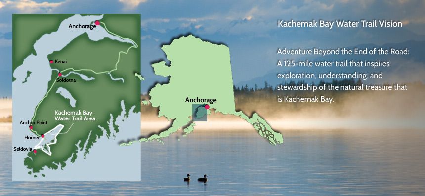
The Kachemak Bay Water Trail is a 125-mile route that extends from the Homer Spit, east along Kachemak Bay to the head of the bay, and further along the southern side of the bay to the City of Seldovia. The water route passes by public and private land, diverse habitat from intertidal areas to alpine trails, and spectacular wildlife viewing opportunities.
Ready to explore the Kachemak Bay Water Trail? Click on the “Plan Your Trip” or “About Us” tabs to get started! Our other links provide further resources and a wealth of information on the Kachemak Bay Water Trail. The water trail can be enjoyed by both motorized and nonmotorized vessels.
Kachemak Bay is a wonderful place to see geology and oceanography at work from time scales of the tectonic plate movements over millions of years to the daily tides. When the mountains around Kachemak Bay were uplifted several million years ago, streams cut steep-sided canyons into the bedrock. These canyons drained into an ancestral Kachemak River that fed into an ancestral river in the Cook Inlet basin, much like today?s Yukon River. Repeated glaciations widened and deepened all of these channels, and a rising sea level turned them into fjords, both for the modern Kachemak Bay as well as sub-bays such as Tutka Bay. The Homer Spit was formed about 16,000 years ago as a submarine terminal moraine during the most recent glaciation. The Homer launch site for the KBWT is located on the Spit. The shape and length of Cook Inlet in turn creates some of the highest tides in the world, with a tidal range (between low and high tide) of up to 28 feet in Kachemak Bay.


 Own or work here?